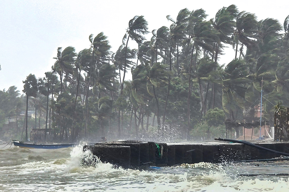
The Bay of Bengal is once again a focal point of intense weather activity as Severe Cyclonic Storm Ditwah rapidly closes in on the Tamil Nadu coast. With less than 24 hours to projected landfall, the cyclonic system has escalated concerns across the state, particularly in coastal districts. The immediate ramifications are already evident, with critical air travel routes, including Chennai-Colombo flights, facing significant disruptions. Authorities are on high alert, urging residents to exercise extreme caution as Ditwah promises to bring strong winds, torrential rainfall, and potential storm surges.
Cyclone Ditwah: Trajectory and Intensification
As of the latest bulletins from the India Meteorological Department (IMD), Cyclone Ditwah has intensified into a severe cyclonic storm, positioned approximately 200 km east-southeast of Cuddalore and 210 km southeast of Puducherry. The system is moving west-northwestwards at a speed of about 15 kmph and is expected to make landfall between Puducherry and Cuddalore by late evening today or early hours tomorrow. However, its expansive cloud bands and strong wind field mean a significant impact is anticipated across a wider stretch of the Tamil Nadu coast, including Chennai and its adjoining areas.
IMD projections indicate sustained wind speeds of 100-110 kmph, gusting up to 120 kmph, near the system’s core during landfall. This level of intensity poses a substantial threat of structural damage, uprooting of trees, and disruption to power and communication lines. Furthermore, districts like Chengalpattu, Villupuram, Cuddalore, Mayiladuthurai, and Nagapattinam are forecast to receive extremely heavy rainfall (above 20 cm) over the next 24 hours, alongside moderate to heavy showers across other northern coastal districts. A storm surge of about 1-1.5 metres above astronomical tide is also predicted for the low-lying areas of the designated landfall zone, posing a risk of inundation.
Preparedness on High Alert: Government and Public Safety
In response to the escalating threat, the Tamil Nadu State Disaster Management Authority (TNSDMA) has activated its emergency protocols. Teams from the National Disaster Response Force (NDRF) and State Disaster Response Force (SDRF) have been strategically deployed in vulnerable districts, including Cuddalore, Nagapattinam, Mayiladuthurai, and Chennai. District collectors are continuously monitoring the situation, and low-lying coastal areas have initiated precautionary evacuations. Over 5,000 relief camps, equipped with essential supplies, have been readied to accommodate displaced residents.
Fishermen have been strictly advised not to venture into the sea until further notice, and those already at sea have been called back to shore. Public advisories include securing loose objects, staying indoors during the storm, avoiding coastal areas, and disconnecting electrical appliances to prevent short circuits. State government officials are working round the clock to ensure minimal loss of life and property.
“The current trajectory suggests a direct hit on a densely populated coastal stretch,” stated Dr. S. K. Raman, a senior meteorologist at IMD Chennai. “While the exact point of landfall can fluctuate slightly, the overall impact zone remains largely consistent. Our primary message to the public is to heed official warnings, stay informed through reliable sources, and cooperate with local authorities for their own safety.”
Travel Chaos: Chennai-Colombo Flights and Broader Disruptions
The impending arrival of Cyclone Ditwah has already begun to wreak havoc on travel plans. Air travel has been significantly affected, with Chennai International Airport announcing the cancellation or rescheduling of several flights. Most notably, the high-traffic route between Chennai and Colombo has seen multiple disruptions. Airlines operating between these two key regional hubs have either cancelled services or faced substantial delays due to adverse weather conditions, poor visibility, and safety protocols for crew and passengers.
Passengers scheduled to fly on these routes are advised to contact their respective airlines for the latest updates before heading to the airport. The disruptions are not limited to air travel alone; railway operations in coastal routes are under review, with potential cancellations or diversions expected. Road transport, particularly along highways close to the coast, is also likely to be impacted by heavy rains, strong winds, and potential waterlogging or falling debris. Port operations in Chennai, Cuddalore, and Karaikal have been suspended, with ships moved to safer waters or advised to remain anchored.
As the nation watches the Bay of Bengal, the coming hours will be critical for Tamil Nadu. Cyclone Ditwah presents a formidable challenge, and the coordinated efforts of disaster management agencies coupled with public awareness will be crucial in mitigating its impact. Residents are urged to remain vigilant, prioritise safety, and follow all official guidelines as the cyclonic storm makes its final approach.


